 View Details
This company has been inactive for more than 7 days. For a safer transaction, we recommend buyers first confirm that the selected company is active and verified.
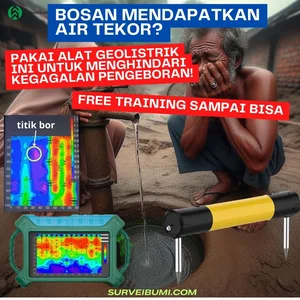
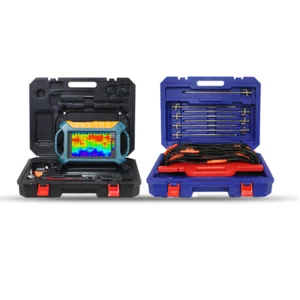
magnetoteluric underground water detector SURVE 300RV 16D
Price
Rp 65.000.000 / Box
*Price excludes VAT. 1 Box Minimum Order
Price is not binding and may change at any time. Get the best price by clicking Request Quotation
- Stock
- 0
- Country of Origin
- China
- Shipped From
- Cakung, Jakarta Timur
- Last Updated
- 28 Oct 2025
Specifications of magnetoteluric underground water detector SURVE 300RV 16D
*peralatan instrumentasi dan kontrol
*GEOLISTRIK SURVE 100M-300M Depth 3D Touch Screen Groundwater Detector**
The GEOLISTRIK SURVE 100M-300M depth 3D touch screen groundwater detector is based on over 47 years of design and exploration R&D. It embodies technology that allows you to use a mobile phone or tablet PC to perform complex data calculations, after which the graphs will automatically form on the mainframe touch screen, be stored in the cloud, and you can communicate with expert advisors online about your graphs.
Additionally, if you use our probe for measurements, you can detect wirelessly. In the “MN input,” you can use traditional MN cable paths or wireless sensors for measurement. If using wireless sensors, there is no need to install cables, and you can measure simply by walking and stopping, free from USB disks and detection buttons. It automatically maps through the phone, communicates with expert advisors online, uploads data to the cloud, and stores it permanently.
Certified ISO9001, the GEOLISTRIK SURVE 100M-3000M depth groundwater detector has obtained numerous patents for its inventions (Patent numbers ZL201320054153.5, ZL201320303919.9), particularly for the invention patent on the Modification of Field Sources from “Geophysical Methods for Modifying the Earth’s Electromagnetic Field Sources and Measuring Instruments,” solving the problem of inconsistent natural electric field intensity sources and losses due to changes at any time.
The real-time imaging water finder is an intelligent real-time imaging water finder developed in collaboration with the Guilin Institute of Hydrology and Geological Exploration. It uses simultaneous input measurements to obtain stable field sources, which not only solves the problem of natural electric field changes at any time but also avoids errors caused by multiple electrode displacements within the same profile, addressing the shortcomings of repeated measurement data profiles from single-channel instruments.
The real-time imaging water finder is equipped with real-time imaging, and the instrument display, mobile screen, and computer screen can all be operated. Measurement channels can be selected, and wireless probes or water searching can be optional. The circular rod can replace the MN electrode measurement mode and TT probe, making field operations very convenient, which is universally recognized by customers.
It has obtained several invention patents (patent numbers: ZL201310205318.9, ZL201110454869.X, ZL201320054153.5, ZL201320303919.9) after registration and has won the High-Tech Achievement Transformation Project Certification in Shanghai.
Can't find the product you're looking for?Request a quotation now
Company Details
- Founded In
- 2022
- Business Field
- -
- Number of Employees
- -
- We Sell
- geolistrik,alat bor
- Address
- kp jembatan jalan marzuki 1, rt 7/17 penggilingan cakung
Cakung, Jakarta Timur, DKI Jakarta
Company Profile
Jasa survei geologi